
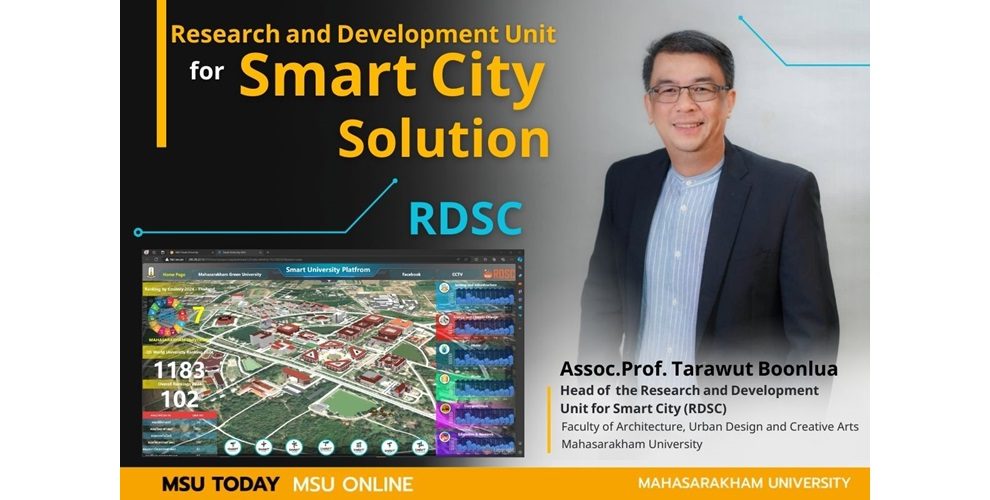
Research and Development Unit for Smart City Solution (RDSC)
The RDSC is a research unit focused on advancing smart city development in line with the government’s policy to promote knowledge among public and private sectors for the development of smart cities. The unit is led by Assoc.Prof. Tarawut Boonlua, a lecturer at the Department of Urban Architecture, Faculty of Architecture, Urban Design, and Creative Arts, Mahasarakham University (MSU).
Project Background
This research has been carried out by integrating knowledge from research and teaching across multiple disciplines, including architecture, urban planning, geography, and information technology. Modern tools such as the Internet of Things (IoT) are utilized, with a focus on advancing new knowledge for architecture students in our faculty. The project also emphasizes the essential use of technology in today’s era for research and teaching by imparting knowledge on developing platforms like Building Information Modeling (BIM) and Geographic Information System (GIS), or Geospatial Intelligence.
Historically, these platforms have operated separately; however, in this research, we have developed and fully integrated the BIM+GIS+IoT platform. This integration results in more modern, visually appealing, and realistic architectural and urban planning representations with city data consolidated into a single platform. This research also incorporates Big Data into the platform, allowing for efficient and rapid representation not just of individual buildings but also of large building clusters and urban communities. Thereby enhancing the knowledge and skills of students in the areas of BIM and GIS, marking a complete integration of BIM, GIS, and IoT.

Objectives
There is a desire to disseminate this type of project to gain acceptance and widespread use at the university level. This involves further integrating BIM, GIS, and IoT to develop the university into a Digital Twin model, progressing towards becoming a Smart University that encompasses the entire university area.
Funding
Regarding funding, we received financial support from external organizations. Last year, we were funded by the National Housing Authority and the Nakhon Ratchasima Provincial Administrative Organization, all of which are external funding sources.

Project Description
The academic collaboration between the Faculty of Architecture, Urban Design, and Creative Arts, led by RDSC, and SuperMap Software Co., Ltd. involves jointly researching projects of this nature. The RDSC research unit, a national and regional leader, is utilizing SuperMap Software technology to concretely develop smart cities in Thailand, with several projects already completed.

Project Highlights
The highlight of this project is the integration of data for visualization and spatial analysis from a broader perspective. It goes beyond beautiful architectural design or using only GIS data by incorporating data into realistic 3D building models. This enables in-depth analysis at both detailed and overall levels, with the capability to connect to IoT systems. For example, data from CCTV cameras, air control systems, and access control systems can be integrated, enhancing the intelligence of the technology. The integration of BIM, GIS, and IoT allows various related systems to connect, such as fire prevention systems and architectural data, which can be displayed through a unified online platform.

Which target group is this project most suitable for?
We began this project at our university since it is the primary user area. Having data at our disposal allows us to efficiently collect and manage it. Therefore, we conceptualized the development of the “Smart MSU University” data platform to make the university more intelligent, starting from existing data from the Faculty of Architecture, such as building information and various infrastructure systems. We conducted research and displayed the results. Currently, we have imported data into the platform through the BIM and GIS processes and are in the phase of integrating various types of data. This is not just ordinary MIS data but is presented as a Digital Twin, a realistic simulation that can access future data and technology through AI, AR, and VR connected to the internet.
We began implementation within different faculties and plan to expand to university-wide management to enhance safety, internal transportation, such as MSU electric buses, and linking data between various university areas. This allows administrators to analyze data within the system, faculty members to use the system for teaching management, and administrators can use this data for planning and decision-making in university development. If successful, this project will serve as an important model for managing complex data and city management, extending from the Smart University City concept to allowing large city data to be efficiently collected and managed for use in the administration of major cities.

Application of this Research
This project is currently in the development phase, guided by policies set by the university administration. At present, we have not received any funding ; instead, we are utilizing the capabilities of researchers in the research unit and graduate students who are assisting with the work, along with collaboration from researchers across various disciplines—not only in architecture but also in geoinformatics and information technology—to create more comprehensive research. We expect that if we can successfully implement this pilot project, we will be able to expand this research to other universities and central agencies, such as the Ministry of Digital Economy and Society or other relevant organizations. We are confident in our ability to successfully complete this work.

What Does It Mean to Be a Smart City?
A smart city is one that has sufficient data for decision-makers to address various issues quickly and accurately. For example, in the event of a fire, there should be effective plans for prevention and access to the incident location. Similarly, in the case of a disaster, appropriate preventive measures must be in place. Additionally, there must be ample information for managing and resolving all issues that arise in the city, with data serving as the foundation for accurate and swift analysis under comprehensive decision-making.
The first step in developing a smart city is the collection of all relevant data for decision-making. This is just the starting point, as there are various platforms that need to be developed to comprehensively address urban issues. For example, in the research project for Nakhon Ratchasima Province (commonly known as Korat), we collected data from the entire province, allowing us to know various details such as related projects, road characteristics, project managers, work progress, and insurance information. In this research, the RDSC has collaborated with the National Telecom Company (NT) to develop the Korat Smart City platform, which can collect and utilize data for efficient decision-making.

Utilizing and Extending Research Outcomes
The benefits of this project include the integration of BIM+GIS data and various Attribute data into a Digital Twin format which can be visualized in 3D. This makes data access easy without the need for special software; a browser is sufficient for data analysis. RDSC collaborates with the GIS company from China, SuperMap Software Co., Ltd., the world’s 2nd-leading company and top in Asia, to study and develop research projects. RDSC is the first in Thailand to apply this technology with tangible research results. Last year, RDSC received the Co-Partner Award 2023 from SuperMap Software at the GISTC 2023 conference in Beijing, affirming our achievements in training and knowledge enhancement for students to pursue future careers. This year, RDSC is also honored to receive the Best Education Partner Award 2024, further confirming our leadership in developing smart city platforms. This has attracted interest from several countries at the International Forum, GISTC 2024. Currently, RDSC is recognized nationally and internationally as a leader in Smart City development in Thailand and Southeast Asia, and is advancing the development of Digital Twin at Mahasarakham University.

Contact Information
To get in touch with us, you can visit the webpage of the Research and Development Unit for Smart City, which showcases academic works and examples of projects we have undertaken. Additionally, there are links to view more details and contact us directly through the website.
RDSC Website Link: rdsc.ac.th
Facebook: https://www.facebook.com/SmartCitybyRDSC/
Original Thai article: https://news.msu.ac.th/msumagaz/smain/readpost.php?mid=577
Leave a Reply